Lewis Road Pedestrian Overcrossing in Agoura Hills

This is the Lewis Road Pedestrian Overcrossing, Caltrans Bridge #53-998, in Agoura Hills. It connects Roadside Drive at Lewis Road on the south to Canwood Street at Lewis Road on the north side of the 101. It was built in 1963 and expanded in 1973.

This is the only pedestrian bridge going over a freeway in the Conejo Valley. There is another pedestrian bridge in Thousand Oaks - the Luedtke Bridge over Olsen Road that connects the CLU main campus to the northern campus.

Tell Me About the History of the Street Names in Casa Conejo in Newbury Park

Casa Conejo is an unincorporated Ventura County community of about 1,000 homes located in Newbury Park. Casa Conejo is a rectangular shaped island within Thousand Oaks city limits, but is not part of the city. Although Casa Conejo is considered part of Newbury Park, it is not part of the majority of Newbury Park within the boundaries of the City of Thousand Oaks.

Casa Conejo Map.jpg

Premiering in 1960, Casa Conejo was the first planned community in Newbury Park. Several folks have asked about the origin of the street names in Casa Conejo. Here goes (with the help of a relative of the original developers):

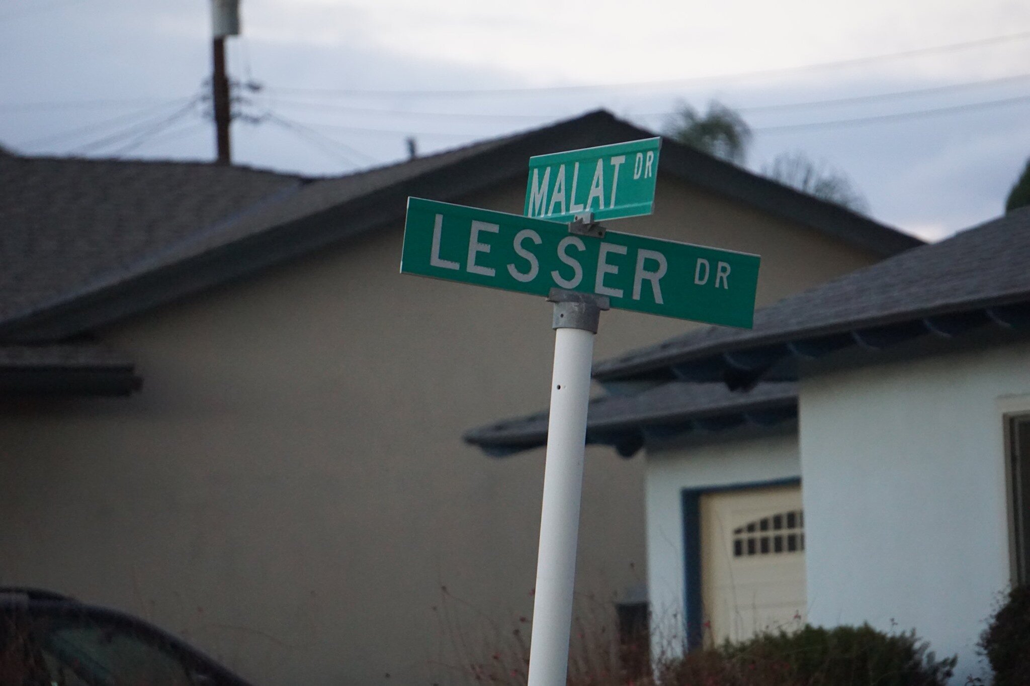
Louis Lesser Enterprises developed Casa Conejo. Members of the Lesser and Malat families created the street names; hence Lesser and Malat Drives, Rudman Drive came from Louis Rudman, also related through marriage to the Lessers, and who managed home sales.

malat and lesser.jpg
rudman and lesser.jpg

William Malat (William Drive) had twin sons, Melvin (Melvin Ct) and Gerald (Gerald Drive). William's wife was Ethel (Ethel Ct). Louis Lesser's wife was Jeanne (Jeanne Ct). Louis Lesser's brother, Alvin "Sonny" was married to Martha (Martha Dr). Louis Rudman's wife was Shirley (Shirley Dr), who was also Ethel’s sister. One of Sonny's daughters is Dena (Dena Dr).

dena and gerald.jpg

Ben (Ben Ct) and Lily (Lily Ct) were Louis and Alvin Lesser's parents. Michael (Michael Drive) is a cousin (by marriage) of the Lessers and Malats. Cathy (Cathy Dr) was one of Louis and Jeanne’s four children. Lisa Rudman (Lisa Ct) is related to the Rudmans (I suspect their daughter).

The jackpot winner was WENDY, who has by far the longest street, not to mention a freeway on/offramp and overpass, named after her! Wendy, who lives in AZ, is a granddaughter of William Malat and daughter of Melvyn. Before it became Wendy Drive in mid-1961, it was called Avenida de la Felicidad.

There are a couple dozen other streets in Casa Conejo that I don’t have the source for at this time, but perhaps I’ll do some more digging:

North/South Streets: Jenny Drive, Gerst Drive, Ruth Drive, Lois Ave, Dorena Drive, Kitty St, Bella Dr, Randy Dr, Debbie St, Cay Ct, Henry Dr, Devia Dr, Virginia Dr, Nellie Ct, Bob Ct, Elinor Ct.

East/West Streets: Frankie Dr, Gloria Dr, Carl Ct, Alice Dr, Lynn Ct, Lois Ct, Verna Ave.

wendy drive.jpg

The History of Lake Sherwood

Lake Sherwood as seen from the Sandstone Peak trail in the Santa Monica Mountains.

Lake Sherwood as seen from the Sandstone Peak trail in the Santa Monica Mountains.

Lake Sherwood is an unincorporated community of about 1,500 residents in Ventura County overlooking the Lake Sherwood reservoir. It is south of Thousand Oaks and west of Westlake Village, off of Potrero Road,  accessible via Westlake Boulevard on the east and Wendy Drive and Reino Road in Newbury Park on the west.

For centuries, the Conejo Valley was inhabited by the Chumash. The Spanish came into the picture in the late 18th century and, when passing through what is now Hidden Valley, named the area the Potrero Valley.

The Potrero Valley was part of the original 48,761 acres constituting Rancho El Conejo. After California became the 31st state in 1850, a land commission was appointed to determine who owned land grants in the area.

Rancho El Conejo was sold in 1872 to John Edwards and Howard Mills. Mills received 22,240 acres that included the Potrero Valley in 1874. Mills sold the southeastern 8,476 acres to Joseph and Isabell McLaren Howard in 1875.

Photo of the Howard Ranch in the 1880s. The Howard residence was near where Triunfo Park is today in Westlake Village. (Courtesy of Conejo Through the Lens Collection; Thousand Oaks Library Special Collections.)

Photo of the Howard Ranch in the 1880s. The Howard residence was near where Triunfo Park is today in Westlake Village. (Courtesy of Conejo Through the Lens Collection; Thousand Oaks Library Special Collections.)

In 1888, the Howards sold the land to the Banning Company of Long Beach. In 1896, W. H. Matthiessen bought the Potrero Ranch from Banning. Then in 1904, Matthiessen built a 45 foot dam (originally called Alturas Dam) that created Potrero Lake (also referred to as Lake Matthiessen). Total capacity of the 156 acre lake, which today is called Lake Sherwood, is 877 million gallons of water.

In the early 1920s, the area around the lake was transformed into Sherwood Forest for the filming of Robin Hood, featuring Douglas Fairbanks. And of course that's where the name Lake Sherwood originated.

Meanwhile, W. H.'s son F. W. "Christy" Matthiessen married Elsie Mack in 1917. The couple made plans to develop the surrounding area as the Las Turas Lake Club in the 1920s. Except...they divorced in 1925, with Elsie receiving the portion of the ranch with the lake.

Elsie remarried. Her new husband's name was James Canterbury and briefly the lake became Lake Canterbury. After the stock market crash of 1929, the Canterburys sold the property to William Randolph Hearst. Hearst allowed the property to be used for filming of many films, including the 1938 The Adventures of Robin Hood.

In 1963, Dayton Realty purchased the lake and surrounding property. Dayton wanted to rezone the land to develop nearly 1,400 homes and commercial properties. This plan was fought off by local residents and rejected by the Ventura County Board of Supervisors.

From late 1983 to summer 1984, Dayton drained the lake, indicating that it needed to test the dam...which never happened...then never refilled the lake, leaving thousands of fish stranded and left to die in the mud. (Photo of draining of lake in January 1984)

Lake Sherwood was made available to the public after the depression of the 1930s until the lake was emptied in 1984.

A view of Lake Sherwood from the north off of Lake Sherwood Drive.

A view of Lake Sherwood from the north off of Lake Sherwood Drive.

In 1985, billionaire businessman David Murdock bought the dry Lake Sherwood lake bed and surrounding property.  His Ventura Farms and Lake Sherwood Ranch are on the old F. W. Matthiessen property in Hidden Valley.

In 1986, heavy rains filled Lake Sherwood back up, though it would take many years for the lake to regain the wildlife it lost after it was emptied.

Murdock developed the community with over 650 homes in three gated neighborhoods along with the Sherwood Country Club and Sherwood Lake Club. The lake is now privately owned and is not open to the general public. 

Fun Things to Do in Historic Ojai, Ventura County's Smallest City

Ojai, Ventura County's smallest city with under 8,000 residents, is 40 miles from Thousand Oaks, the 2nd largest city in the county. This drive is well worth it if you're looking for a unique old town feeling right here in Ventura County.

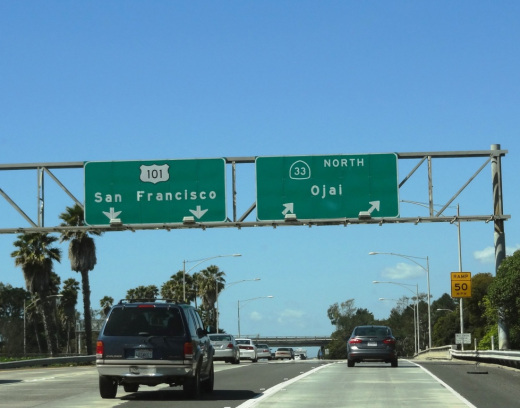
OjaiFreewaySign.JPG

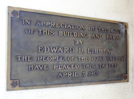
Incorporated as a city in 1921, the Ojai Valley was once inhabited by the Chumash Indians. The name Ojai is derived from the Chumash word "Awhai," meaning "moon." Glass manufacturer Edward D. Libbey helped create the layout of Ojai. After a fire destroyed much of the town in 1917, the western-style town received a new Spanish Revival look.

View of the arcade and pergola in front of Libbey Park on Ojai Avenue.

View of the arcade and pergola in front of Libbey Park on Ojai Avenue.

The Ojai Post Office tower and portico was completed in 1917 and is a focal point for the city at the corner of Ojai Avenue and Signal Street. The tower was modeled after the Christopher Columbus Cathedral in Havana, Cuba, with additional details from Mexico. The tower complements the arcade and pergola along Ojai Avenue. You can't miss the one block arcade with its shops, eateries and art galleries.

OjaiPostOffice.JPG
LibbeyTablet.JPG

Here's a selection of just some of the great things to do in Ojai:

The Ojai Valley Inn and Spa is a great local weekend getaway! Whether you stay there overnight or not, the Ojai Valley Inn's historic 18 hole golf course, 31,000 sq ft spa and fitness facility and four lighted tennis courts are available to local day trippers.

Libbey Bowl and Libbey Park are located in the heart of Ojai next to the downtown arcade area. Libbey Bowl, originally built in 1957 and completely renovated in 2011, is used for the annual Ojai Music Festival, Storytelling Festival, Ojai Day celebration, holiday events and much more. Libbey Park provides plenty of sitting areas, shade trees, a kids' playground in the heart of the city.

Strolling and shopping in the Ojai Arcade

Strolling and shopping in the Ojai Arcade

Founded in 1966, the Ojai Valley Museum at 130 West Ojai Avenue maintains an extensive collection of art, Native American baskets, pioneer tools and photographs of early days in Ojai.

Meditation Mount

Meditation Mount

Located on a 32 acre site overlooking the Ojai Valley, Meditation Mount is a public meditation center that has invited the public to its beautiful grounds since opening in 1970. Two hour visitation experiences are $12 at designated time frames. meditationmount.org

The Ojai Valley Trail provides cyclists, equestrians, runners and strollers a nine mile path paralleling Highway 33 from Foster Park on the north end of Ventura to Soule Park on west of downtown Ojai. My personal favorite activity in Ojai is riding bikes on this trail.

The Ojai Playhouse is a single screen theater originally built in 1914 that has been restored to its deco-style look inside and now shows first run movies in a theater that seats over 200 people. The Ojai Film Society hosts eclectic, independently produced movies here on Sunday afternoons.

NOTE: The Ojai Playhouse has been closed since January 2018 to restore the theater due to a water main break causing damage and flooding to the building. They anticipate re-opening in 2024. Check www.facebook.com/ojaiplayhouse for updates.

The Ojai Trolley Service provides transportation on a fixed route schedule throughout Ojai, Meiners Oaks and Mira Monte. Where else can you find a year-round trolley around here!?

OjaiTrolleyPic.JPG

Ojai Day was originally conceived in 1917, took a long hiatus in the 1920s, and came back in 1991 on the third Saturday of each October. The event showcases the best Ojai has to offer, with entertainment, a parade, art, food, games and much more. Visit www.ojaiday.com for more information.

One of my favorite activities with the kids just minutes from Ojai is the Lake Casitas Recreation Area, which includes the seasonal (Memorial Day to Labor Day weekend) Casitas Water Adventure. Though the water is not heated, the 1,200 foot lazy river and multi-level water jungle gym for the kids is sure to entertain you while cooling you off.

Casitas Water Adventure

Casitas Water Adventure

For other year-round things to do in Ojai, click here in the Do Something section of CVG or here for kids' activities. Or here for Fitness & Sports activities. And for upcoming Ojai events, click here. To learn more about the city, visit the City of Ojai website at ojaicity.org.

Aviation Museum of Santa Paula is Open to the Public the First Sunday of Each Month

The Santa Paula Airport was dedicated in August 1930. Today it is a non-towered facility with nearly 300 aircraft, handling approximately 97,000 arrivals/departures a year. Much of the original 1930’s-era facilities still exist and are used today, giving the airport a very authentic representation of the Golden Age of Aviation.

Located at the Santa Paula Airport, the Aviation Museum of Santa Paula is open the first Sunday of each month, with an array of hangars open to the public from 10 a.m. to 2 p.m.

Upcoming dates: May 5, 2024

SPAirport_Dedication.JPG

Each of the privately owned hangars houses a variety of vintage aircraft and collections of various types, as well as other memorabilia, such as antique radios, model aircraft and race cars. Some hangars celebrate highlights of fascinating aviation careers, while others contain antique aircraft undergoing the process of restoration. Hangar owners or docents are available to answer questions. 

SPAviationMuseum.JPG

You've got to take the time to stop by. It is fun, low key and quite interesting. The hangars are directly adjacent to the airfield, so you are guaranteed to see aircraft taking off and landing up close.

Obviously an aviation aficionado in this hangar!

Obviously an aviation aficionado in this hangar!

The participating hangars are fairly well spread out at the 51 acre airport but if you're not up for walking, there's a complimentary tram that will take you around. These are some very nice people who have obvious passion for what they do and enjoy sharing it with the general public. I struck up conversations with several hangar owners and they were full of great stories and information.

AviationMuseumTram.JPG

There is no charge for visiting the Aviation Museum, though donations are welcomed. Visit www.aviationmuseumofsantapaula.org or call 805.525.1109 for more information.

The Museum is not open on rainy days.

Directions: Arriving by car from the east, exit the Santa Paula Freeway (SR 126) at 10th street, turn right off the ramp, and then a quick left onto Harvard Boulevard. Turn left at the next signal at Eighth Street, under the freeway, left onto Santa Maria Street and park in the lot. Arriving from the west, exit the freeway at Palm Avenue, turn right and then a quick left onto Santa Maria Street, about a half mile to the end at the parking lot.

Lots to see, both inside and outside of the hangars.

Lots to see, both inside and outside of the hangars.

Mugu Rock Then and Now

Mugu Rock is a large rock formation formed when a 200 foot deep cut was made into the rocky ridge from October 1937 to February 1940. Prior to the modern day PCH at Mugu Rock (at the time called U.S. 101 Alternate (State Route 60), drivers went around a 275 foot radius curve that is now fenced off.

The photos in the video above from the October 1940 edition of California Highways and Public Works show what it looked like before, during and after the cut was made, compared to what it looks like today.

The Carpinteria Tar Pits are One of Five Natural Asphalt Lake Areas in the World

The Carpinteria Tar Pits at Carpinteria State Beach are located in a designated area called Tar Pits Park. The Carpinteria Tar Pits are one of five natural asphalt lake areas in the world, 2nd in size to and older than the La Brea Tar Pits in Los Angeles.

These tar pits date back to the Pleistocene Age (Ice Epoch), which 2.6 million to 11,700 years ago. Evidence of imperial elephants, the giant sloth, bison, wolf, tusked mastodons and camels have been discovered in t

Read More