Tell Me About the History of the Street Names in Casa Conejo in Newbury Park

Casa Conejo is an unincorporated Ventura County community of about 1,000 homes located in Newbury Park. Casa Conejo is a rectangular shaped island within Thousand Oaks city limits, but is not part of the city. Although Casa Conejo is considered part of Newbury Park, it is not part of the majority of Newbury Park within the boundaries of the City of Thousand Oaks.

Casa Conejo Map.jpg

Premiering in 1960, Casa Conejo was the first planned community in Newbury Park. Several folks have asked about the origin of the street names in Casa Conejo. Here goes (with the help of a relative of the original developers):

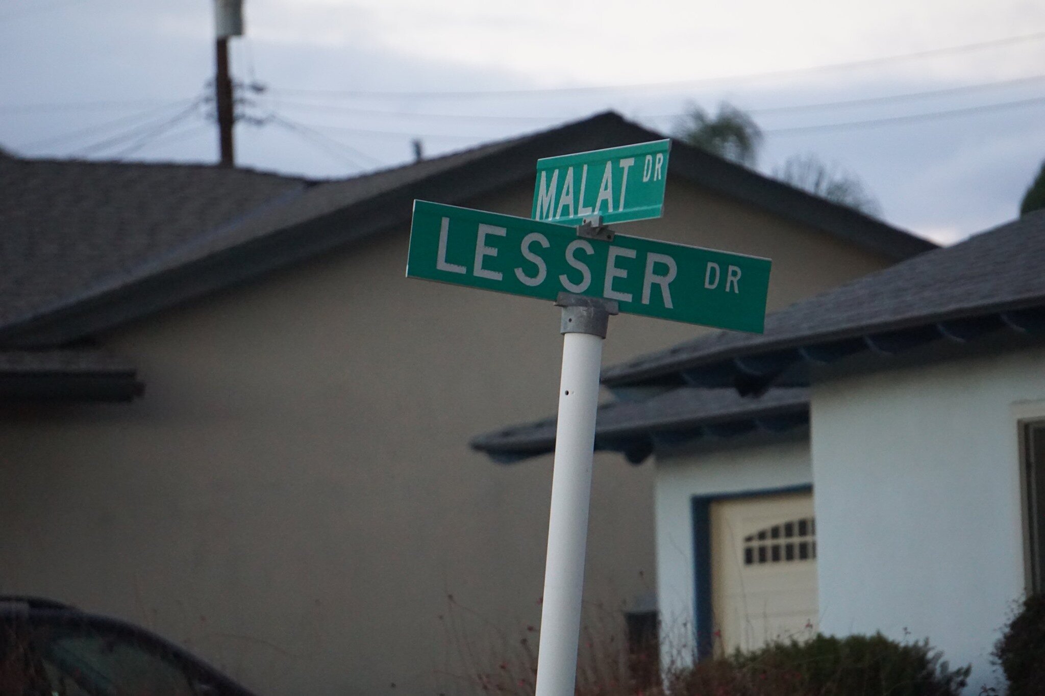
Louis Lesser Enterprises developed Casa Conejo. Members of the Lesser and Malat families created the street names; hence Lesser and Malat Drives, Rudman Drive came from Louis Rudman, also related through marriage to the Lessers, and who managed home sales.

malat and lesser.jpg
rudman and lesser.jpg

William Malat (William Drive) had twin sons, Melvin (Melvin Ct) and Gerald (Gerald Drive). William's wife was Ethel (Ethel Ct). Louis Lesser's wife was Jeanne (Jeanne Ct). Louis Lesser's brother, Alvin "Sonny" was married to Martha (Martha Dr). Louis Rudman's wife was Shirley (Shirley Dr), who was also Ethel’s sister. One of Sonny's daughters is Dena (Dena Dr).

dena and gerald.jpg

Ben (Ben Ct) and Lily (Lily Ct) were Louis and Alvin Lesser's parents. Michael (Michael Drive) is a cousin (by marriage) of the Lessers and Malats. Cathy (Cathy Dr) was one of Louis and Jeanne’s four children. Lisa Rudman (Lisa Ct) is related to the Rudmans (I suspect their daughter).

The jackpot winner was WENDY, who has by far the longest street, not to mention a freeway on/offramp and overpass, named after her! Wendy, who lives in AZ, is a granddaughter of William Malat and daughter of Melvyn. Before it became Wendy Drive in mid-1961, it was called Avenida de la Felicidad.

There are a couple dozen other streets in Casa Conejo that I don’t have the source for at this time, but perhaps I’ll do some more digging:

North/South Streets: Jenny Drive, Gerst Drive, Ruth Drive, Lois Ave, Dorena Drive, Kitty St, Bella Dr, Randy Dr, Debbie St, Cay Ct, Henry Dr, Devia Dr, Virginia Dr, Nellie Ct, Bob Ct, Elinor Ct.

East/West Streets: Frankie Dr, Gloria Dr, Carl Ct, Alice Dr, Lynn Ct, Lois Ct, Verna Ave.

wendy drive.jpg

Aviation Museum of Santa Paula is Open to the Public the First Sunday of Each Month

The Santa Paula Airport was dedicated in August 1930. Today it is a non-towered facility with nearly 300 aircraft, handling approximately 97,000 arrivals/departures a year. Much of the original 1930’s-era facilities still exist and are used today, giving the airport a very authentic representation of the Golden Age of Aviation.

Located at the Santa Paula Airport, the Aviation Museum of Santa Paula is open the first Sunday of each month, with an array of hangars open to the public from 10 a.m. to 2 p.m.

Upcoming dates: May 5, 2024

SPAirport_Dedication.JPG

Each of the privately owned hangars houses a variety of vintage aircraft and collections of various types, as well as other memorabilia, such as antique radios, model aircraft and race cars. Some hangars celebrate highlights of fascinating aviation careers, while others contain antique aircraft undergoing the process of restoration. Hangar owners or docents are available to answer questions. 

SPAviationMuseum.JPG

You've got to take the time to stop by. It is fun, low key and quite interesting. The hangars are directly adjacent to the airfield, so you are guaranteed to see aircraft taking off and landing up close.

Obviously an aviation aficionado in this hangar!

Obviously an aviation aficionado in this hangar!

The participating hangars are fairly well spread out at the 51 acre airport but if you're not up for walking, there's a complimentary tram that will take you around. These are some very nice people who have obvious passion for what they do and enjoy sharing it with the general public. I struck up conversations with several hangar owners and they were full of great stories and information.

AviationMuseumTram.JPG

There is no charge for visiting the Aviation Museum, though donations are welcomed. Visit www.aviationmuseumofsantapaula.org or call 805.525.1109 for more information.

The Museum is not open on rainy days.

Directions: Arriving by car from the east, exit the Santa Paula Freeway (SR 126) at 10th street, turn right off the ramp, and then a quick left onto Harvard Boulevard. Turn left at the next signal at Eighth Street, under the freeway, left onto Santa Maria Street and park in the lot. Arriving from the west, exit the freeway at Palm Avenue, turn right and then a quick left onto Santa Maria Street, about a half mile to the end at the parking lot.

Lots to see, both inside and outside of the hangars.

Lots to see, both inside and outside of the hangars.

Hiking to the Waterfall in Pt Mugu State Park from Rancho Sierra Vista/Satwiwa

One of the most popular hikes in the Rancho Sierra Vista/Satwiwa open space in Newbury Park is to a small waterfall in the adjacent Boney Mountain Wilderness. The hike is about 3 1/2 miles round-trip from the Satwiwa Native American Indian Culture Center and is a moderate hike that can be done by all ages.

Keep in mind that in drought years, there’s sometimes not more than a trickle flowing down this waterfall, while in rainier years like 2023-2024, the waterfall is quite active. In either case, it’s a fun hike to do.

You have two primary options for where to start the hike. You can drive into the Rancho Sierra Vista park entrance on Via Goleta in Newbury Park and park in a lot that is a brief walk to the Culture Center, or you can park at the Wendy Drive and Potrero Road trailhead and add an another two miles, round trip, to your adventure.

The entrance to Rancho Sierra Vista/Satwiwa at Via Goleta, 1 mile west of Reino Road.

The entrance to Rancho Sierra Vista/Satwiwa at Via Goleta, 1 mile west of Reino Road.

The trailhead where Wendy Road ends at Potrero Road in Newbury Park

The trailhead where Wendy Road ends at Potrero Road in Newbury Park

The Satwiwa Native American Indian Culture Center is a small building open from 9am to 5pm on weekends where you can learn about native Chumash items and local wildlife.

The Satwiwa Native American Indian Culture Center is a small building open from 9am to 4pm on weekends (as of April 2024) where you can learn about native Chumash items and local wildlife.

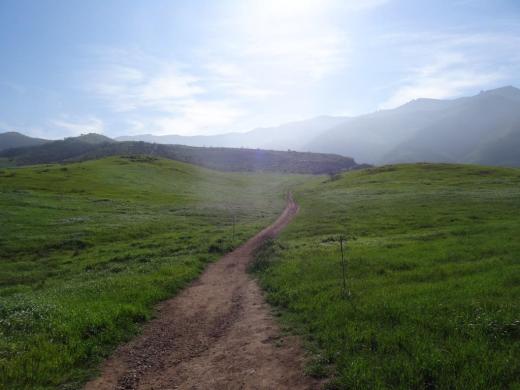
Next to the Culture Center, you'll see multiple paths, all of which can get you to your destination, but the most direct path is the Satwiwa Loop Trail seen on the left, which crosses through a meadow that can be quite green and beautiful in late Winter/early Spring and dry and brown the rest of the year. An alternate route is on the right of the picture above - the Big Sycamore Canyon Trail (paved road) to the Boney Mountain Trail, where you'll take a left.

Satwiwa Loop Trail section that takes you diagonally through the meadow. Seen here when it is nice an green.

Satwiwa Loop Trail section that takes you diagonally through the meadow. Seen here when it is nice and green.

At the end of the meadow, continue straight up a fairly steep hill, where on the right hand side you'll see the Sycamore Canyon Overlook bench shown below.

RSVW_sycoverlook.JPG

bench on sycamore canyon overlook

Hike up the moderately steep and rocky path up the hill behind the bench and you'll reach another fork in the road. If you veer left at this juncture you'll be on the Hidden Valley Overlook Trail within Rancho Sierra Vista/Satwiwa. Stay to the right and you'll be entering the Boney Mountain Wilderness area within Point Mugu State Park.

Sign that shows you the Hidden Valley Overlook Trail is on the left.

Sign that shows you the Hidden Valley Overlook Trail is on the left.

Veering right into the State of California managed Pt Mugu State Park; as you can see, dogs are not allowed in the back country area of the park.

Veering right into the State of California managed Pt Mugu State Park; as you can see, dogs are not allowed in the back country area of the park.

This trail is referred to as Danielson Road, named after the last private owner of these lands. The path down into the canyon is seen below (taken from a higher point en route to the Danielson Monument).

View of the initial section of Danielson Road trail down into the canyon; this is the path you will be taking towards the waterfall.

View of the initial section of Danielson Road trail down into the canyon; this is the path you will be taking towards the waterfall.

Danielson Road is a bit on the steep side but I see folks young and old walking up and down this section all the time. Seen here in very dry conditions.

Danielson Road is a bit on the steep side but I see folks young and old walking up and down this section all the time. Seen here in very dry conditions.

RSVW_waterfalltrailsign.JPG

THIS IS THE OLD SIGN, WHEN IT WAS CALLED DANIELSON ROAD (PRIOR TO 2024)

NEW SIGN IN 2024 SHOWING THE “OLD CABIN TRAIL” INSTEAD OF DANIELSON ROAD.

After .4 mile, you will reach the bottom of the canyon and see the sign above, the final sign indicating you are on your way to the Waterfall Trail. Then you will cross a creek bed, which can have water in it after the rains. The photo taken below in January 2015 shows minimal moisture, making it easy to cross. Some years you may have to rock hop your way a bit over the creek.

RSVW_stream.JPG

Creek bed crossing on the way to the waterfall IN 2015

Creek Crossing in April 2024.

After you cross the creek, the remainder of the trail to the waterfall is single track. Be careful not to come in contact with poison oak often seen on the sides of the trails. For this reason, I would generally not recommend strollers be taken up here.

Soon you will reach the final fork in the road. Go straight and soon you will be at the waterfall. To the right, the Old Cabin Trail (formerly Danielson Road Trail) continues upward to the Danielson Monument.

RSVWaterfallFeb17.JPG

the waterfall in april 2024.

Mugu Rock Then and Now

Mugu Rock is a large rock formation formed when a 200 foot deep cut was made into the rocky ridge from October 1937 to February 1940. Prior to the modern day PCH at Mugu Rock (at the time called U.S. 101 Alternate (State Route 60), drivers went around a 275 foot radius curve that is now fenced off.

The photos in the video above from the October 1940 edition of California Highways and Public Works show what it looked like before, during and after the cut was made, compared to what it looks like today.

The "Scary Dairy" at CSU Channel Islands University Park in Camarillo

CSU Channel Islands University Park is a 367 acre parcel located adjacent to CSU Channel Islands off of S. Lewis Road in Camarillo. It is a regional educational and recreation area owned and operated by California State University Channel Islands.

In 1932, the State of California purchased 1,760 acres of the Lewis Ranch and built the Camarillo State Mental Hospital, which operated from 1936 to 1997 and at one point treated as many as 7,000 patients in the mid 1950s.

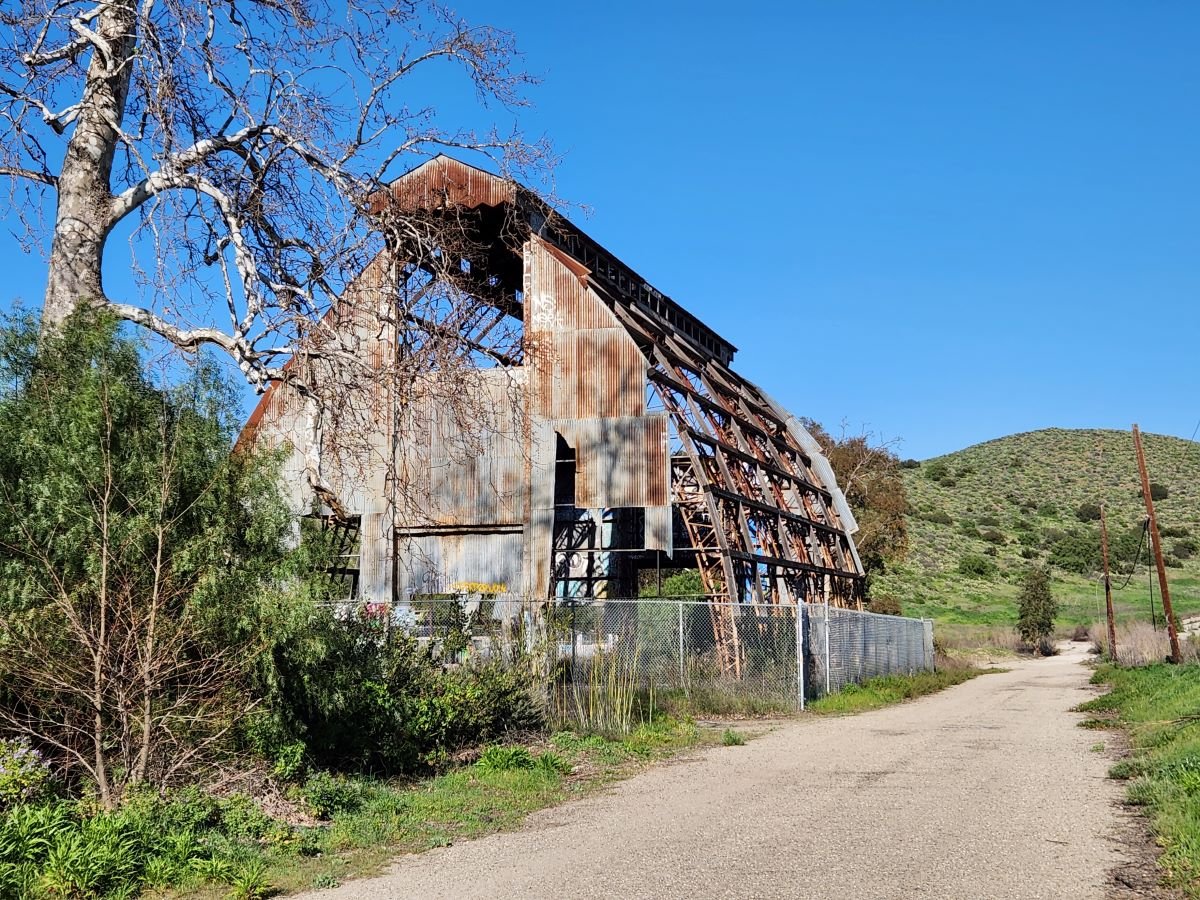
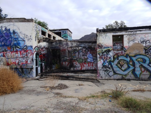
Located on the parcel was a dairy farm that produced crops and housed livestock that fed the hospital community. The farm was disbanded in the 1960s and has been left in a state of disrepair, falling prey over the decades to vandals and coined "Scary Dairy."

After closure of the hospital, the land was conveyed to the County of Ventura, which had considered developing a golf course and amphitheater there but later abandoned its plans. The land was acquired by the University in 2009.

Fences and "No Trespassing" signs now surround what's left of the structures. but you can still get pretty close to check out Scary Dairy.

ScaryDairy1.JPG

CSU Channel Islands University Park is open to the public daily from sunrise to sunset. From Camarillo, take Lewis Road south to Camarillo Street and turn left (east).  Cross the bridge over Calleguas Creek and the entrance is on the left. Parking is $6 per vehicle (as of 2022). Do note that there are no facilities at this park, like restrooms and drinking fountains.

Visit www.csuci.edu/cipark for more information.

ScaryDairy4.JPG
ScaryDairy5.JPG
ScaryDairy7.jpg
ScaryDairy3.JPG

The Carpinteria Tar Pits are One of Five Natural Asphalt Lake Areas in the World

The Carpinteria Tar Pits at Carpinteria State Beach are located in a designated area called Tar Pits Park. The Carpinteria Tar Pits are one of five natural asphalt lake areas in the world, 2nd in size to and older than the La Brea Tar Pits in Los Angeles.

These tar pits date back to the Pleistocene Age (Ice Epoch), which 2.6 million to 11,700 years ago. Evidence of imperial elephants, the giant sloth, bison, wolf, tusked mastodons and camels have been discovered in t

Read More

Hillside Letters in the Conejo Valley and Greater Ventura County

There are over 500 hillside letters, or “mountain monograms,” in the United States, including 81 in California. What are hillside letters, you ask. They are simply large single letters, abbreviations and sometimes even messages erected on a hillside, usually by a school or town.

The Big “C” overlooking UC Berkeley (From Wikipedia; public domain)

The Big “C” overlooking UC Berkeley (From Wikipedia; public domain)

One well known hillside letter is a giant concrete block letter “C” built in the hills overlooking UC Berkeley that was constructed on March 23, 1905.

We have our share of hillside letters here in the Conejo Valley and Greater Ventura County, some of which you may be aware of…others, perhaps not.

The mountain monograms visible in our neck of the woods include:

The letters CLU on Mt. Clef Ridge above Cal Lutheran University are maintained by students.

Hilltop A overlooking Agoura High School up a steep hill. Made out of wood, I believe.

Here is a view of the letter VC north of Ventura College in late April 2019.

Here is a view of the letter VC north of Ventura College in late April 2019.

If you drive north up Catalina Street, west of Ventura High School, you will be able to see this letter V on the hillside.

The letter F is located in the hills west of Fillmore and is quite easy to see.

This letters SP letters in the hills south of Santa Paula is cleared brush. They originated originated in 1922. More information on THIS PAGE.

Happy Face Hill in Simi Valley is not a mountain monogram but is perhaps the visible hillside attraction throughout Ventura County.